GPS Data Collection
We charge $10 per point collected. This includes travel and data processing.
We collect almost any type of Feature and build a database that you can use as you see fit.
Examples:
- Roads (centerlines, edges)
- Sidewalks and trails
- Bridges and tunnels
- Intersections
- Railways
- Parking lots and parking spaces
- Airports and runways
- Property boundaries
- Parcels and lot corners
- Easements and right-of-ways
- Survey control points
- Fence lines
- Driveways
- Building footprints
- Construction layouts
- Excavation boundaries
- Stockpiles
- Buildings
- Addresses
- Zoning boundaries
Custom PDF Maps
This varies on the complexity of project but $55 per hour is the standard. All projects will be quoted before we begin so you understand what is being done and how long it will take to complete.
Custom Interactive Online Maps
There are two types of online interactive maps:
- Static online maps allow you to decide what feature you want to display – these are public maps that anyone can see and use. We host these on our server, and you do not need a login to access it. These are view only maps that you can access anywhere you have internet.
- Static maps cost $55 an hour to setup depending on their complexity and have a yearly hosting fee of $100
- Dynamic online maps allow you to decide what feature you want to display – these are private maps that will require a login to access. They can be setup, so you’re able to edit or track features. These are downloadable maps that will work without internet (you will need internet to upload any edits you made while offline.)
- Dynamic maps cost $55 an hour to setup depending on their complexity, have a yearly hosting fee of at least $100, and a yearly Login fee between $250 – $750 depending on the level of user control you want.
Scanning large format documents
We have the ability to scan large format paper documents that have one side that is 36 inches or smaller. It takes 30 minutes to setup the scanner whether we scan 1 or 100 pages and because of that we have a 5 page or $25 minimum charge. We charge $5 for each page after that.
Large format Printing
We have the ability to print documents and maps that are up 3 feet wide and 6 feet long. The two types of documents we print most often are Planimetric and Imagery.
- Planimetric is $3 per SqFt
- Imagery is $4 per SqFt
Map Lamination
We have the ability to laminate documents that are up 3 feet wide and 6 feet long. Lamination is $1 per SqFt
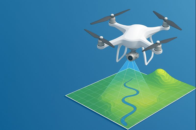
High Resolution Aerial Imagery
We use drones to collect high-resolution imagery, which has greatly improved our ability to create and maintain up-to-date information. Drones allow us to map large areas quickly, often in hours instead of days or weeks, resulting in faster data collection and more efficient project completion.
Because drone imagery is captured from low altitudes, it produces highly detailed maps, 3D models, and elevation data. When combined with GPS or ground control points, this data can achieve a high level of accuracy. Drones can also easily map locations that are difficult or impossible to access on foot, including wetlands, forests, rooftops, cliffs, and disaster-affected areas.
In addition, drones provide current, real-time data, making them ideal for tracking changes over time such as construction progress, erosion, crop growth, or environmental damage. Drone mapping also supports 3D modeling and volume calculations, which are valuable for stockpile measurement, earthwork analysis, and terrain assessment.
What we can map with our drone:
Land & Topographic Mapping
- Elevation and contour maps
- 3D terrain models
- Slopes and drainage patterns
- Cut-and-fill calculations
Construction & Engineering
- Construction site progress maps
- Earthwork volumes and stockpiles
- Site planning and layout
Agriculture Mapping
- Field boundaries
- Irrigation patterns
- Plant counts and spacing
- Soil variability
Environmental & Natural Resource Mapping
- Forest coverage and tree counts
- Wetlands and water bodies
- Erosion and floodplains
- Wildlife habitats
- Shoreline changes
Urban & Planning
- City blocks and neighborhoods
- Zoning and land-use patterns
- Roof inspections and measurements
- Parking lots and traffic flow
Emergency & Disaster Mapping
- Flood extent mapping
- Wildfire damage assessment
- Landslide areas
- Search-and-rescue terrain mapping
Mining & Quarrying
- Pit and quarry measurements
- Stockpile volumes
- Site safety planning
- Reclamation monitoring
Surveying & GIS Data Collection
- High-resolution orthomosaic maps
- 3D point clouds
- Digital elevation models (DEM/DSM)
- Asset mapping for GIS systems
Historical & Cultural Mapping
- Archaeological sites
- Historical structures
- Preservation planning
Pricing
Drone pricing follows our standard $55 per hour but is negotiated on a project-by-project bases – contact us for a quote.